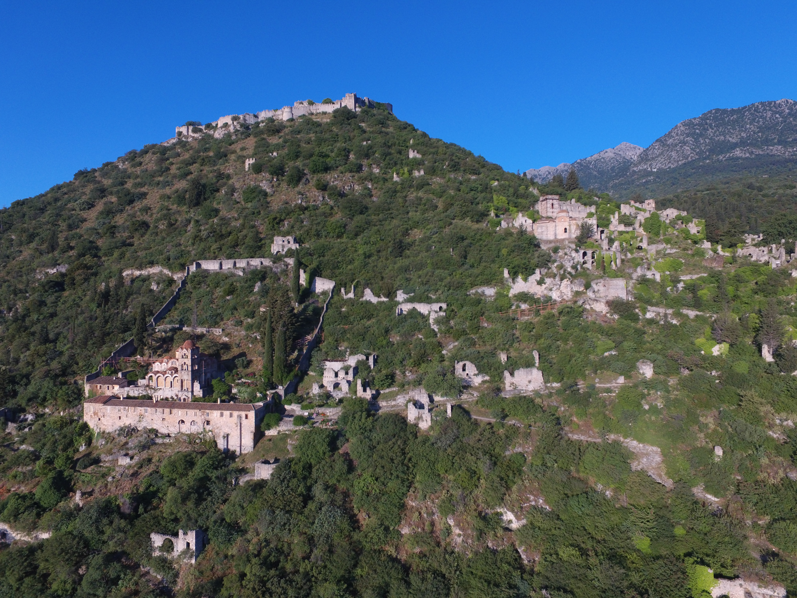
Mystras Castle City
Historical point
The layout of the castle state is in three distinct zones, with a significant difference in altitude: Ano, Kato and Exo Chora. In addition there is also the citadel at the top.
In Ano Chora, the Palaces of the Despots stand out. They have been built in different periods (13th-15th centuries) and form a large complex dominated by the throne room.
In Kato Chora, the Metropolis stands out, i.e. the church of Agios Dimitrios, where the last emperor of Byzantium, Constantine XI Paleologos, was crowned on January 6, 1449.
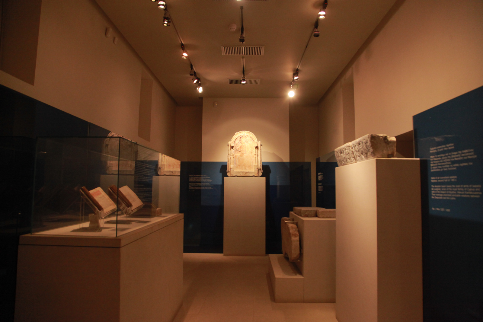
Archaeological Museum of Mystras
Museum
The Archaeological Museum of Mystras is housed in the western wing of the Metropolis courtyard. The collection includes sculptures, architectural members, portable icons, frescoes, jewelry and other objects which date from the Early Christian to the Post-Byzantine years.
Important exhibits are a 14th-century marble slab depicting the Ascension of Alexander the Great, two tombstones with monograms of the Kantakouzen family, while the most important exhibit are parts of a silk women’s dress and a woman’s hair braid from a nobleman’s tomb found in Hagia Sophia in Mysteries. Of particular interest is the collection of small crafts with Byzantine and Venetian works (coins, rings, etc.), as well as the collection of ceramics from the Byzantine period.
“Takis Aivalis” Camera Museum
Museum
The “Takis Aivalis” Camera Museum was inaugurated in 2013 and was created by the donation of the personal collection of cameras of the well-known photographer Takis Aivalis. The museum exhibition presents the evolution of 20th century cameras that were mainly aimed at the amateur user. The collection includes approximately 1,000 cameras, which in 2001 earned their owner a place in the Guinness Book of Records.

Cave of Kaiada
Historical point
With the name Kaiadas, in antiquity, it referred to a great chasm near ancient Sparta, at the foot of Mount Taygetus. Today the cavern is located near Trypi, next to the Sparta-Kalamata public road. Some identify it with the “Apothetes”, where the ancient Spartans are said to have thrown away crippled or malnourished infants in order to ensure the eugenics of their race.
Kaiadas, from the few historical references, is identified as a place where criminals and prisoners of war were thrown. Strabo calls it “the binding cave of the Lacedaemonians”. In the village of Parori there is indeed the opening of a dark cave, but Pausanias, in his description of Aristomenes’ escape from Caias, refers to a steep and deep gorge, analogous to the “chasm” of the Athenians, from the opening of which only one fox could pass.
According to historical reports, the hero of the 2nd Messenian war Aristomenes Andanieus was thrown by the Spartans into Kaiada along with 50 captive Messenians. During his fall, however, Aristomenes first managed to hold by the wings of an eagle and then by the tail of a fox that led him to the exit. Also in Caias the Spartans dumped the dead body of their king Pausanias who had been sentenced to death for treason.
Kaiadas is about 10 kilometers from today’s Sparta, and is located in a gorge near the village of Trypi. Its entrance has been embanked and today it has a diameter of half a meter. Its explored section is 50 meters long and has a slope of 35° – 50°. The cave was known for many years to have bones inside, but the first systematic investigation took place in 1983. The bones form a thick layer deep in the cave. The bones come from adult males along with a few females. It is argued that the bones did not end up scattered there, but were dropped as whole bodies.

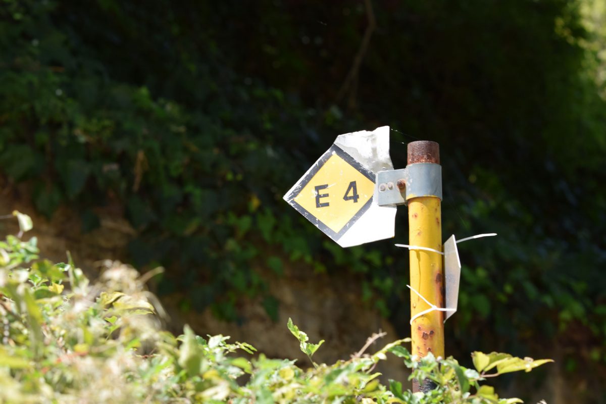
European trail E4
Activity
The European long-distance trail E4 is an international trail established by the European Mountain Walking Association (E.W.V.) in the following countries: Spain, France, Switzerland, Germany, Austria, Hungary, Romania, Bulgaria, Greece and Cyprus.
In the Greek section, the E4 route passes from the Promachona-Serres road to the Strymonas river bridge, where it intersects with the E6 and reaches Greece at the outpost of Niki, north of Florina. Continuing south it crosses the mountains of Vernon, Vermio, Pieria and Olympus, to end up through the massif of central Greece at Delphi. It passes, after the Gulf of Corinth, to Kalavrita and from there to Planeteros. It then enters Arcadia from Lykuria and follows the sources of Ladon, passes through Pangratio and reaches Dara. Of course, it includes Tripoli for an overnight stay. Then it passes through Vytina, passes through Levidi and climbs to the Mainalo Refuge. Then, passing through the Tripoli-Kalavryton road, it reaches Kapsa and Perithori, it returns to Tripoli and from there to the Stadium, Psili Vrysi, it passes through Ano Doliana and reaches Agios Petros. From here it passes through Karyes and Bresthena to leave the borders of Arcadia, ending up in Sparta and Gytheion. Then it crosses Crete from the prefecture of Chania to the prefecture of Lasithi. Then from Larnaca in Cyprus it ends in Paphos.
Climbing field of Lagkada
Activity
A few kilometers after the settlement of Trypi, at the 15th km of the Sparta-Kalamata road, there is the climbing park of Lagada. This is one of the few climbing fields in Greece where, due to the altitude and location of the field (canyon), climbing is possible even on the hottest days of the summer season. This fact, combined with the intense relief presented by the rock and the beauty of the natural landscape of the area, rank Lagada as one of the most popular and important climbing sports fields in Greece. It has 97 sports routes that are developed in five fields: Aloni, Petsanes, Tourlitsa, Splithari and Stani. All climbers can train, since it has everything from training routes for beginners to routes for the most experienced.

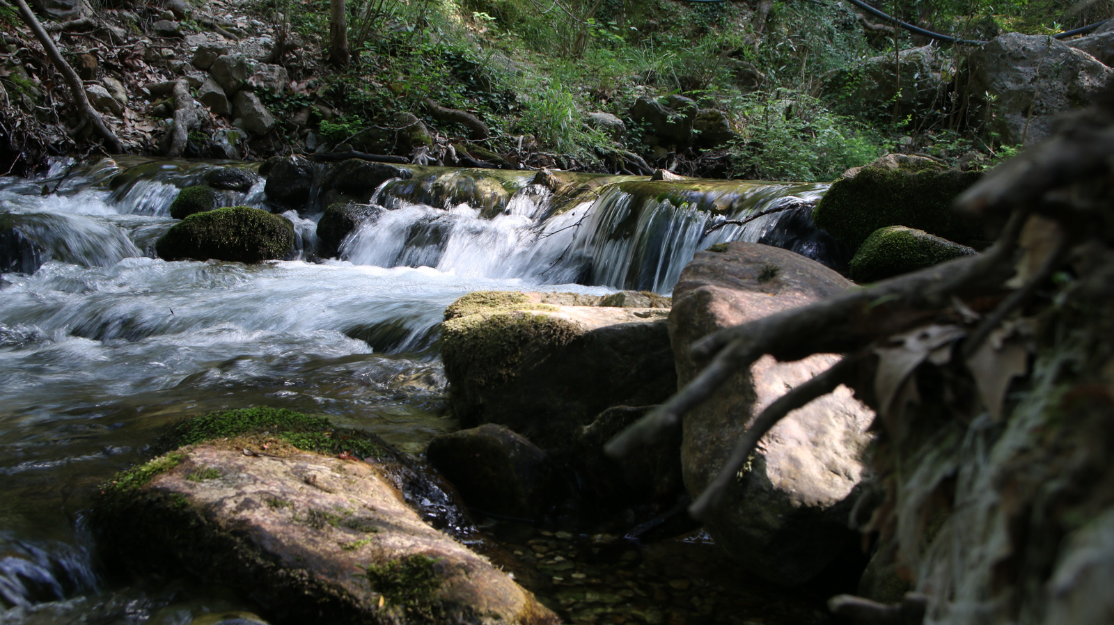
Sources and waterfalls of Knakion River
Natural environment
Explore the enchanting nature at the sources of the Knakion River to enjoy the crystalline frozen waters that spring from the Taygetos. During the summer, the place attracts many adventurous visitors who dive into the “lumbes” as the locals call them, the natural pools formed in the frozen waters of the river. If you can’t stand the cold water you can just relax and enjoy the wonderful images of nature. In winter here you will also find an impressive waterfall that usually flows until the beginning of summer.
Spanakaki peak
Activity
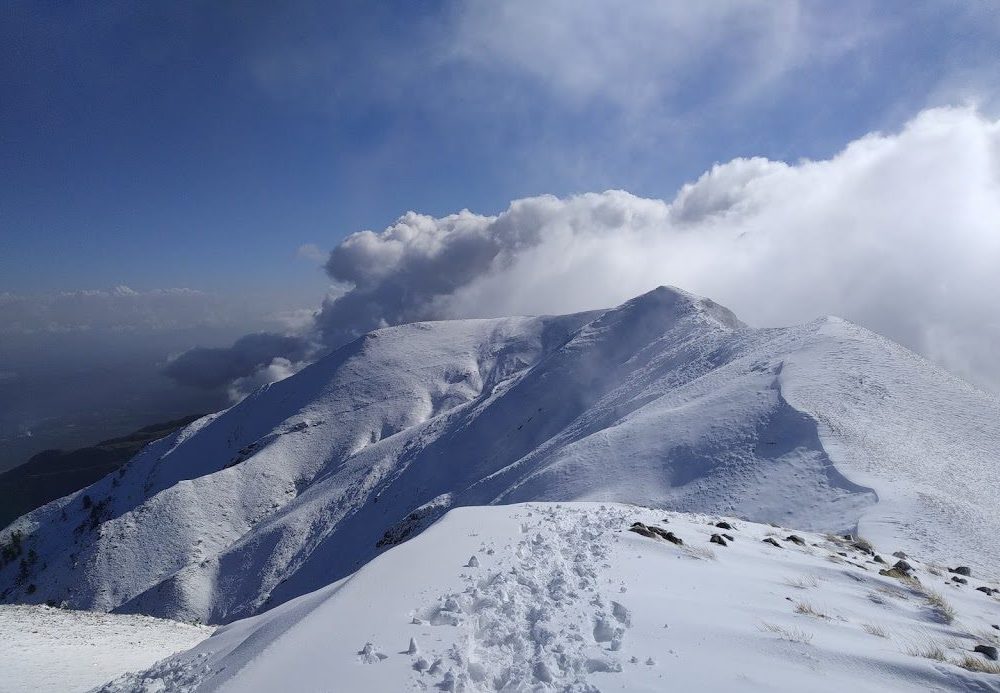
In the Northern Taygetos there are peaks such as Xerovuna (1,852 m), Neraidobrachos (1,784 m), Lepenou (1,733 m) etc. In the Central Taygetos are the highest peaks of the mountain range: Prophet Ilias (2,407 m), Sidirokastro (2,228 m), Chalasmeno Vouno (2,204 m), Vasiliko Vouno (2,100 m), Spanakaki (2,098 m), Neraidovuna (2,031 m) and Ai Giorgis (2,019 m). South Taygetos is lower, with the highest point being Sangias (1,217 m).

Neraidovouna peak
Activity
In the Northern Taygetos there are peaks such as Xerovuna (1,852 m), Neraidobrachos (1,784 m), Lepenou (1,733 m) etc. In the Central Taygetos are the highest peaks of the mountain range: Prophet Ilias (2,407 m), Sidirokastro (2,228 m), Chalasmeno Vouno (2,204 m), Vasiliko Vouno (2,100 m), Spanakaki (2,098 m), Neraidovuna (2,031 m) and Ai Giorgis (2,019 m). South Taygetos is lower, with the highest point being Sangias (1,217 m).

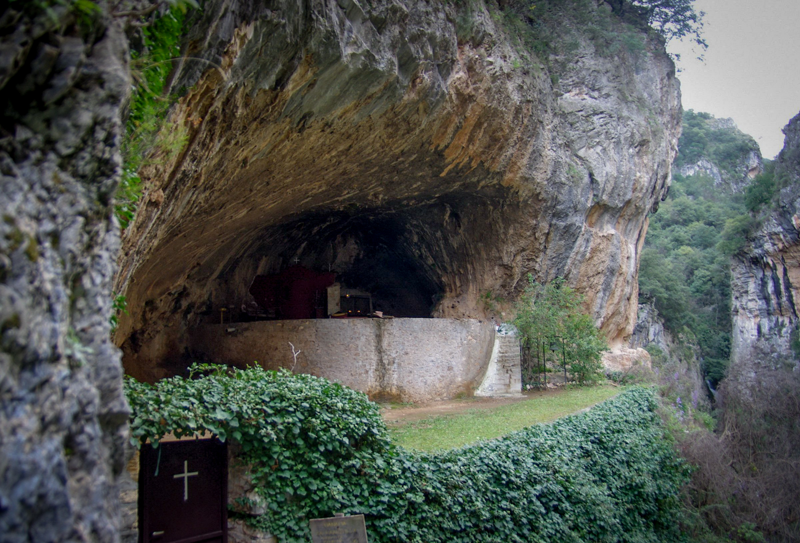
Lagadiotissa church
Church / Monastery
In Parori, next to the beautiful square, where the many and cold waters of the Keramos springs flow, a serpentine path begins that after just 15 minutes will lead you to the small church of Panagia Lagadiotissa, built in the 12th century literally inside the rock . Legend has it that Constantine Palaiologos ministered here when he set out for Constantinople.
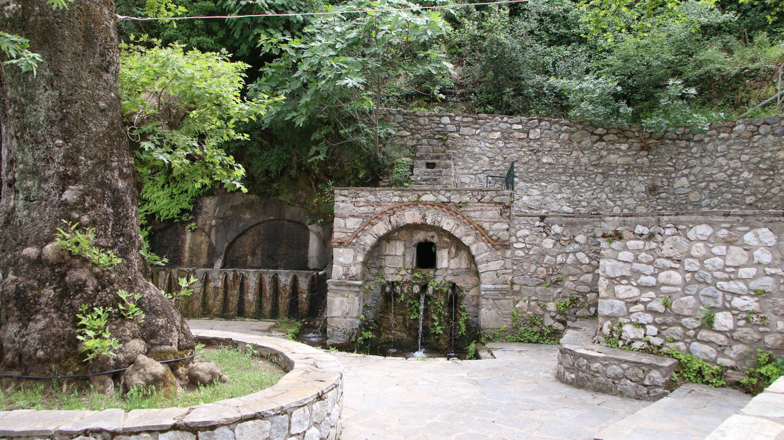
Springs of Keramos
Spring / Fountain / Well
The springs of Keramos are located in the square of Parori village.


Car
From Athens: 218 km, 2.5 hours
From Kalamata: 98 km, 1 hour
The route follows the A6 (Attiki Odos), A8 (Elefsina-Corinth) and A7 (Corinth-Tripoli) highways, and then the A71 (Lefktro-Sparti) highway.
Bus
From Athens: 226 km, 3.5 hours
From Kalamata: 102 km, 1 hour
KTEL Lakonia operates several daily routes to and from Athens. These routes also serve the Sparta-Tripoli and Sparta-Corinth lines.
From the airport
From Eleftherios Venizelos – Athens Airport: 248 km, 2.5 hours
From Kalamata airport: 96 km, 1 hour
The road transition from Kalamata to Sparta takes about an hour. The route follows the A7 highway (Kalamata-Tripoli) and then the A71 highway (Lefktro-Sparti).
For road access to the paths of the present study, the following road network can be used:
The Sparti – Logastra provincial road
The Spartis – Kalamata highway
The national road Spartis – Mystras
The Spartis – Gytheio national road
The Spartis-Mystra provincial road
Amykles-Kalyvia Sochas street
Kalyvia Sochas – Sochas street
Mystra-Pikoulianika street
Mystras-Taygeti street
Taygeti – Pergandaika street
The Mystras-Vlahochori street
Agios Ioannis-Anavrytis street
In addition to the above paved roads, there are a number of existing forest and rural roads, mainly dirt, which allow access to the existing paths.
Η περιοχή προσφέρει μεγάλη ποικιλία χώρων διαμονής για όλα τα γούστα. Μπορείτε να βρείτε πέτρινα παραδοσιακά σπίτια και ξενώνες, μικρά ξενοδοχεία, resorts πολυτελείας και ενοικιαζόμενα δωμάτια, στο Μυστρά, Παρόρι, στα Πικουλιάνικα, στην Τρύπη, στην Αναβρύτη και στην Ταϋγέτη.
Για περισσότερες πληροφορίες: https://www.exploresparta.gr/tourism/diamoni/
From the main local products of the Spartan land the following stand out: olives of the “Kalamon” variety & virgin olive oil, oranges, honey, wine with the typical Kydonitsa, Mavroudi, Roditis, Athiri and Agiorgitiko varieties, synglino, sausage, pasta, trout and salmon.
Some of the most typical traditional dishes that you can look for on your trip are: Bouzopoula, Kokoras bardouniotikos, Pitaroudes, Kayanas, Kolokythokorphades.
More info at exploresparta.gr
Hiking boots, hat, sunscreen, long pants, water at least 1.5 liters, food, compass, whistle, flashlight, knife or multi-tool, watch and baton. In winter, windproof jacket, waterproof and isothermal clothes.
We also suggest that you never walk alone and always have a first aid kit with you. A well-charged mobile phone will come in handy in difficult situations.
You can hike all year round, except in the winter months when snow may close some paths. Spring and autumn are considered the best seasons thanks to mild temperatures and colourful nature. Due to the altitude, the air can be strong and icy. In summer (July, August) it may be hot enough to walk.
It is important toBefore every hike we are informed about the weather conditions.
We do not stray from the boundaries of the path.
We use fireplaces and avoid fires.
We don’t leave trash. On the path we collect rubbish that may have been left by others.
We do not destroy the vegetation, we respect the historical monuments and the local populations.
We respect wild animals and do not feed them.
Source: trailpath.gr
In the past, there were large mammals that today have disappeared such as bears, deer, roe deer, wolves and even the lynx. Today, 19 mammals have been observed in the mountain fauna, including the fox, badger, ferret, hare and hedgehog. Wildcat and jackal have also been reported although the population status of these species is not well documented. The only large mammal that is often seen is the wild boar.
In the event of the appearance of snakes, as a preventive measure, the hiker can be careful where he steps and where he puts his hands. If you encounter a snake, stay calm and keep a distance of at least two to three meters without disturbing it. In the event that you are bitten by a snake, stay calm, call 166 or 112 and take no action at all, except go to the health center with the help of an attendant. We recommend that you never walk alone.